Brazil's biggest favela mapped using 3D laser scanning
Favelas 4D – a project from MIT’s Senseable City Lab – has created a 3D model of Brazil’s biggest favela, Rocinha in Rio de Janeiro.
The largest favela in Brazil has been mapped using 3D technology. A favela is a term used locally to describe an unplanned and impoverished community on the outskirts of a city.
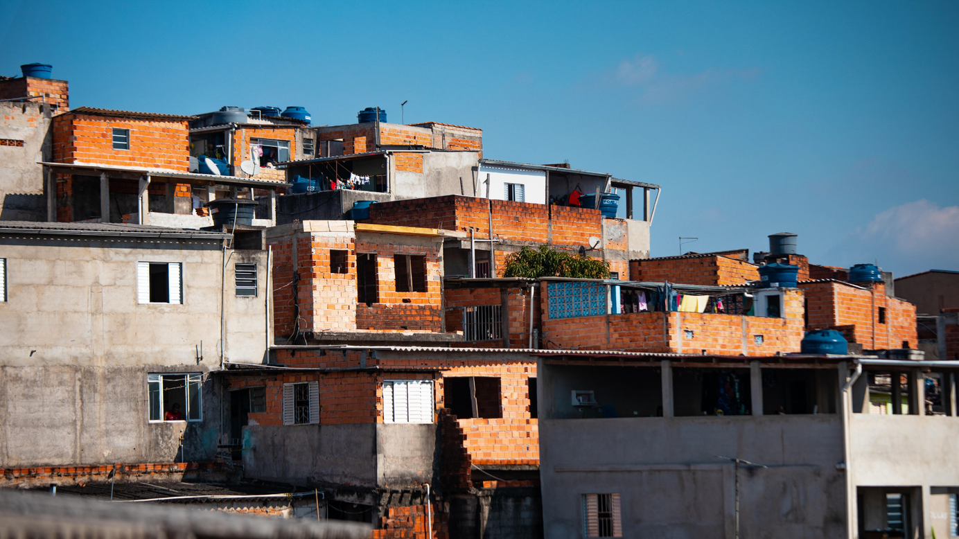
One of the numerous favelas that sprung up around Brazilian towns is Rocinha, which is located in Rio de Janeiro. Favelas are generally overcrowded with people and have too many houses for traditional technologies like satellite mapping to examine.
However, researchers in Rocinha, a city of around 100,000 people, got around this issue by employing portable 3D scanners.
The researchers are from the Massachusetts Institute of Technology's (MIT) Senseable City Lab, which conducts research on cities and cutting-edge technology.
4D Favelas
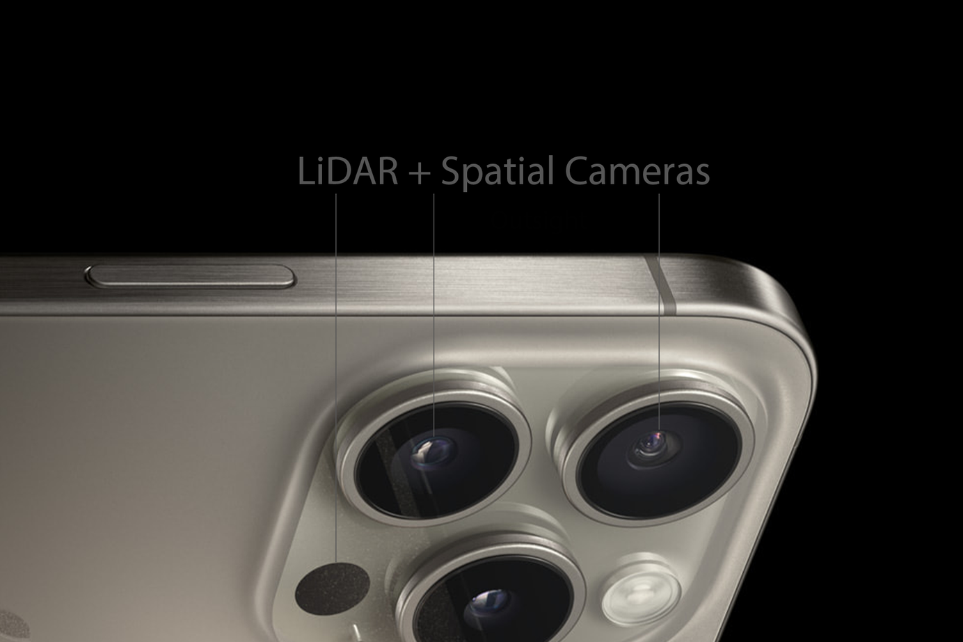
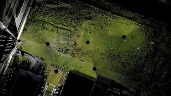
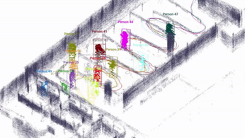
Researchers have used a 3D laser scanning technique known as LiDAR, or Light Detection and Ranging, to construct a virtual representation of Rocinha for a project called Favelas 4D.
LiDAR operates by firing infrared light pulses and timing how long it takes for them to reflect off of targets. This generates a 3D point map of the immediate area.
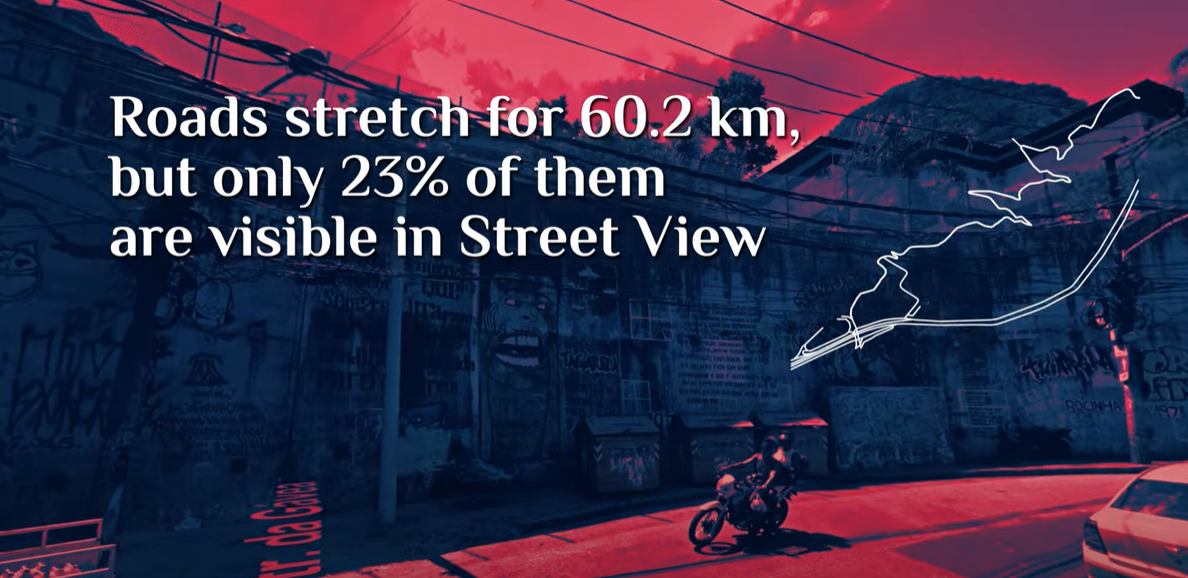
According to the authors, to photograph the 1.5 square kilometer neighborhood, researchers had to negotiate narrow lanes and rising slopes.
The project is led by Italian architect Carlo Ratti, who directs the MIT Senseable City Lab, in collaboration with Rio de Janeiro’s city planning commissioner, Washington Fajardo.
STAY ON TOP OF THE NEWS
Join the free newsletter to receive the latest updates in your inbox.
Improving favelas
Nearly 1 billion people live in informal settlements worldwide, according to the Favelas 4D team. Despite their enormous size, these settlements are invisible and "devoid of urban rights" since they cannot be mapped.
These regions could not have access to official assistance, administration, or business prospects, for instance. According to MIT researchers, residents of favelas experience poor living conditions and have shorter life expectancies.
Urban design modifications, such as demolishing buildings to allow more light or air into the area, might enhance living circumstances.
LiDAR INSIGHTER Newsletter
Join the newsletter to receive the latest updates in your inbox.
