
A new Multi-vendor 3D LiDAR Simulator
From airports to mobile robots, smart cities, and industrial applications, Outsight has a LiDAR simulator several use cases and applications.
The new 3D LiDAR Simulation tool created by Outsight is the only LiDAR simulator available on the market that doesn't require any programming and functions with any kind of LiDAR.
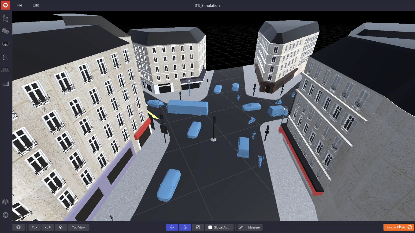
For instance, the simulation of traffic flow could include pedestrians, cars, and buses being scanned by a single LiDAR. To estimate coverage in various scenarios, the LiDAR may be moved and aimed in various directions.
Why use a 3D LiDAR Simulator
Because of Outsight's expertise creating LiDAR Software Solutions for a variety of applications, they are aware of the concerns customers have regarding the best sensor to use and how to utilize it.
This familiarity has allowed them to design solutions that are both simple and scalable.
Several customers have already benefited from the 3D LiDAR Simulator's ability to forecast performance based on each setup and use case by making the best decisions and configuring their LiDAR project.
Outsight Cloud
No software has to be installed on the client's PC, just a connection to Outsight Cloud in order to use the simulator.
After the access is ready, simulations may be used to investigate the ideal LiDAR configuration and assess the performance of the coverage.
Also, users can upload data recordings (.pcap files), share files, and obtain LiDAR maps (.ply files).
How the Simulator works
Once the client's has decided to start a new simulation, they will need to:
1. Create a scenario that matches their use-case
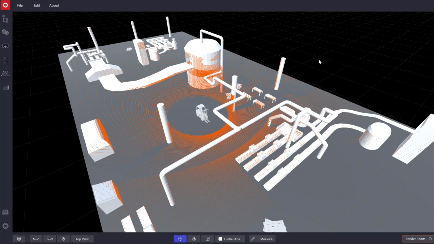
The built-in tools for editing 3D forms may be used to construct a user's own 3D scene to serve as a background.
2. Insert 3D objects
There is a wide variety of 3D objects available in the simulator, including people, trees, and different types of vehicles and two-wheelers.
3. Pick the right LiDARs for their application
The user may select the suitable model, or a combination of models, from a number of manufacturers (360° FoV, Narrow Field of View, Dome), by navigating through an extensive list of compatible LiDARs.
Most LiDAR manufacturers and models, including those from Hesai, Livox, Velodyne, Ouster, Robosense, Blickfeld, Innovusion, and Innoviz, are compatible with the Simulator.
4. Find the optimal LiDAR coverage
By experimenting with different options and coverage levels, one may determine the ideal trade-off between performance, hardware expense, and complexity.
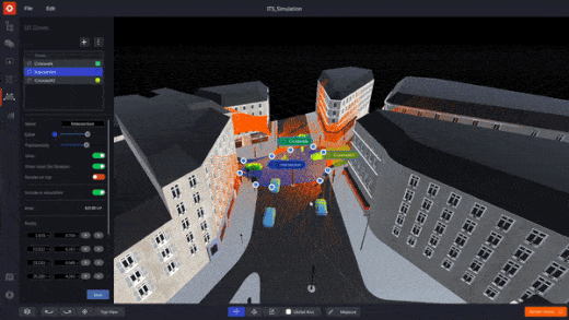
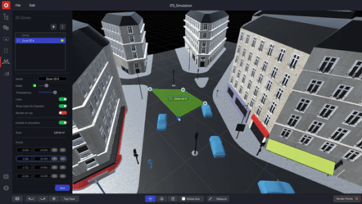
5. Focus on Zones of Interest
The client will feel comfortable using the Simulator's user interface if they are familiar with the family of Augmented LiDAR Software products.
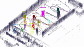
There are a variety of fascinating applications for this, including crowd monitoring in sensitive places and crossing surveillance prediction.
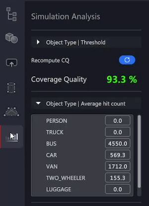
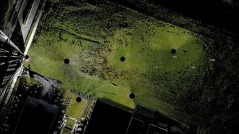
6. Check the detailed Simulation Analysis
The Simulator's computation of coverage quality produces precise results in an easy-to-understand indicator.
Custimization
Seamless import of 3D models:
Several background photos and external 3D objects may be included into a simulation using an elegant preview selection.
3D shapes and zones editor:
Designing, modifying, and customizing high quality 3D zones and shapes has never been easier.
Optimize workload
Milti-item management:
The user may simultaneously move, alter, and modify the properties of several objects, forms, and LiDARs, which helps to speed up processes when many LiDARs are involved. This functionality was added in response to user input.
Multiple LiDARs or large premises:
Without the right equipment, it might be challenging to choose the best arrangement of LiDAR models and their locations.
The software and simulator solutions from Outsight help our clients to maximize the value and cost of the solution.
LiDAR INSIGHTER Newsletter
Join the newsletter to receive the latest updates in your inbox.

