The seven qualities of a LiDAR Software Open Data Format
It's crucial to check that any 3D LiDAR processing software employs an open and common data format that satisfies seven essential requirements
It's crucial to check that 3D LiDAR processing software employs an open and common data format that satisfies seven essential requirements.
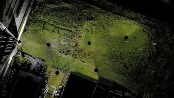
LiDAR Data can be extremely helpful in gathering critical RAW data points.
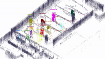
With processing software like Outsight's, raw data from LiDAR may be transformed into actionable insights, enabling applications to make excellent use of them, such as accurately recognizing and monitoring individuals.
The flexibility to output a certain data format independently of the input device is a significant benefit of utilizing a software processor that is independent of the sensing LiDAR hardware (and very frequently in a project you need a combination of sensors from different manufacturers).
When LiDAR technology initially emerged, its proprietary data formats and protocols made sense since they sped up the time it took for new hardware devices to transmit raw data to the market.
The initial LiDAR prototypes weren't meant to be used in mass manufacturing. The early users had the problem of deciphering each unique format.
An open data format is one that has a publicly accessible published specification and imposes no limitations on use, whether financial or otherwise. As a result, conformant software can read and write data in that format, making it possible for others to implement it.
The key characteristics of an open LiDAR data format
1. Open
The system must be open in order for it to operate without the need of private intellectual property.
As open proprietary formats may be utilized without limitations and can facilitate switching from one technological platform or environment to another without jeopardizing legal agreements, this will reduce the risk of utilizing the system.
Moreover, intellectual property is often open to the public, increasing security and enabling access to a wider variety of technical platforms and applications.
2. Simple
Also, the processing system must be easy to use.
It is easier to say than to do: more complicated formats might be more efficient in some specific use situations, and simplicity thus represents a trade-off between usability, time to market, and performance.
3. Robust
One of the most important qualities to consider while choosing a LiDAR processing software is its resilience. For instance, the message body should permit the placement of data pieces in any sequence.
This makes decoding drivers more easier, prevents problems, and makes the following feature possible:
4. Backwards-compatible
At every level of your data processing procedure, your processing Lidar software should be able to meet your demands.
There may be many versions of the software coexisting in the same network and system since companies like Outsight routinely produce new versions that can't always be instantly distributed throughout your whole installed fleet.
5. Efficient
The last thing you want when employing a LiDAR processing software is for it to waste time, which would slow down your operations and potentially jeopardize real-time capabilities.
6. Adaptable
Moreover, to ensure that only pertinent information is provided at all times, your system must be able to respond to user demands in real-time without altering its organizational structure or decoding patterns.
7. Flexible
Your LiDAR software must be capable of handling data of any size.
There will be occasions when you need to employ a straightforward and modest amount of data, such as when using a single, low-resolution LiDAR.
This covers uses where a large number of LiDAR sensors are combined to provide a single output stream.
Hence, without changing the data format, your system should be adaptable and easily available to expand and manage data of any amount.
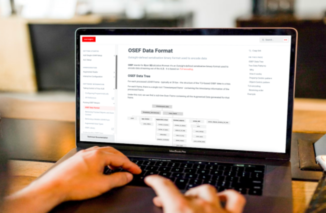
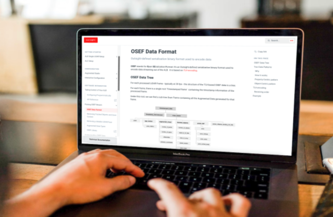
An example of Open Data format for LiDAR software
Outsight's Augmented LiDAR Software uses OSEF [Open SErialization Format] to provide its results.
It employs TLV-encoding, a method for optional informative pieces that includes code for time, length, and value.
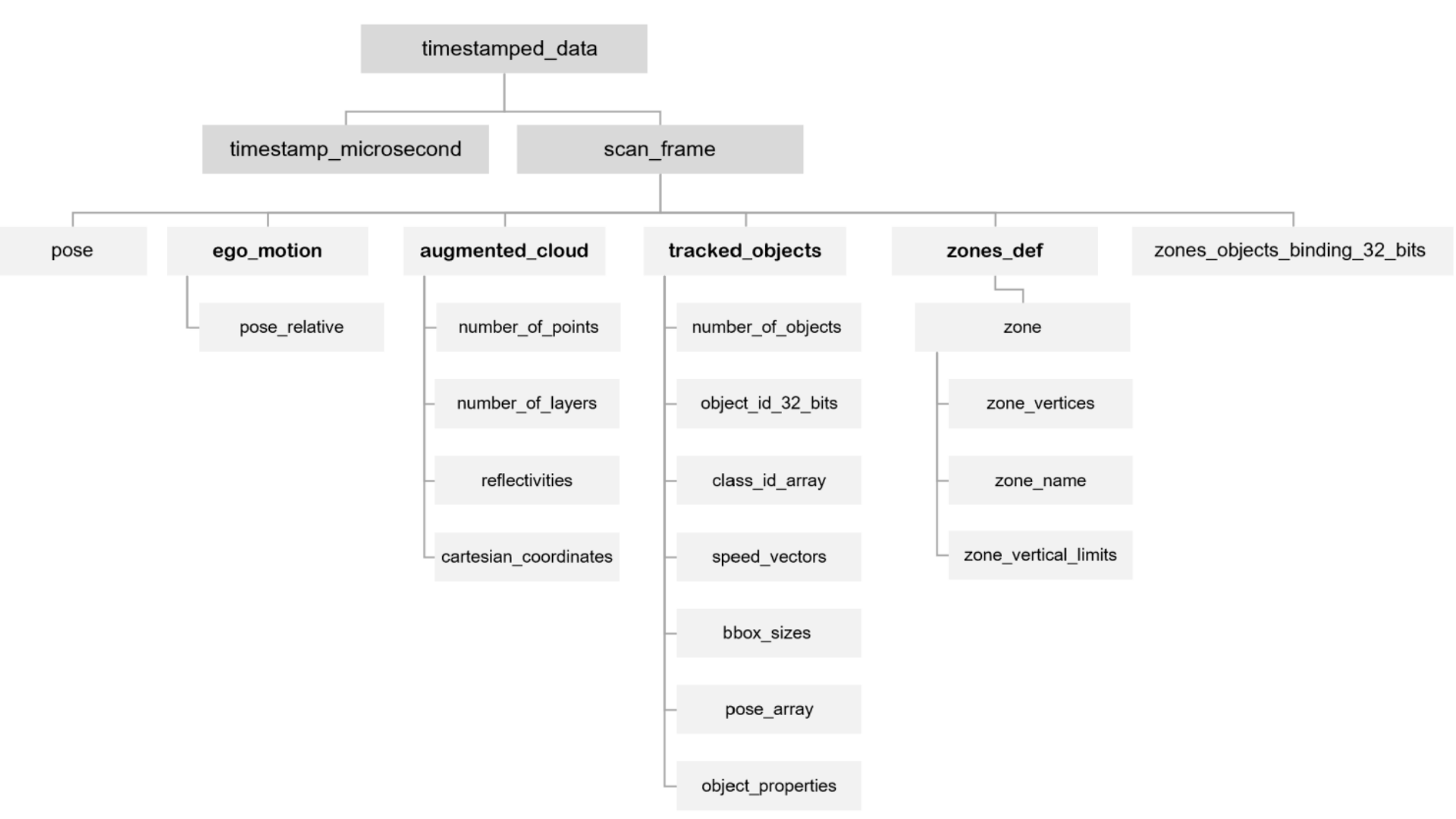
As shown in the picture below, the structure of the OSEF data is a tree that stores the timestamp information and all of its properties, such as Ego-Motion and Tracked Objects' information, at each processed LiDAR Frame, generally at 20 frames per second.
You will be able to fully utilize an open and standard data format that is open, simple, robust, backwards-compatible, effective, adaptive, and flexible with the help of the augmented LiDAR software.
Learn more here:

LiDAR INSIGHTER Newsletter
Join the newsletter to receive the latest updates in your inbox.


