
LiDAR Software enables Intelligent Traffic Systems (ITS)
With the demand for 3D sensors growing around the world, LiDAR software has become an important part of making roads safer and more efficient. This makes it an essential part of Intelligent Traffic Systems (ITS).
Populations are expanding quickly in metro areas all over the world, which has led to new and urgent problems including increasing traffic, traffic-related mortality, and higher carbon emissions.
By comparison, the cost of congestion in the US and Europe was projected at USD 87 billion and EUR 110 billion, respectively, in 2019. However, following the pandemic, automobile sales are once again on the rise internationally, with an average growth projection of 2% through 20303.
These elements have underlined the necessity and significance of expanding ITS solutions more than before.
Yet, accurate perception and situational awareness are needed for flow monitoring to be effective while maintaining the privacy of residents. Here is where LiDAR is to be considered among the most prominent technologies.
The 3D data from LiDAR offers very accurate, comprehensive spatial measurements (LiDAR mapping accuracies may go up to 1 cm) and operates in a variety of situations and circumstances, such as at night or in direct sunshine, unlike conventional 2D-based perception technologies like cameras.
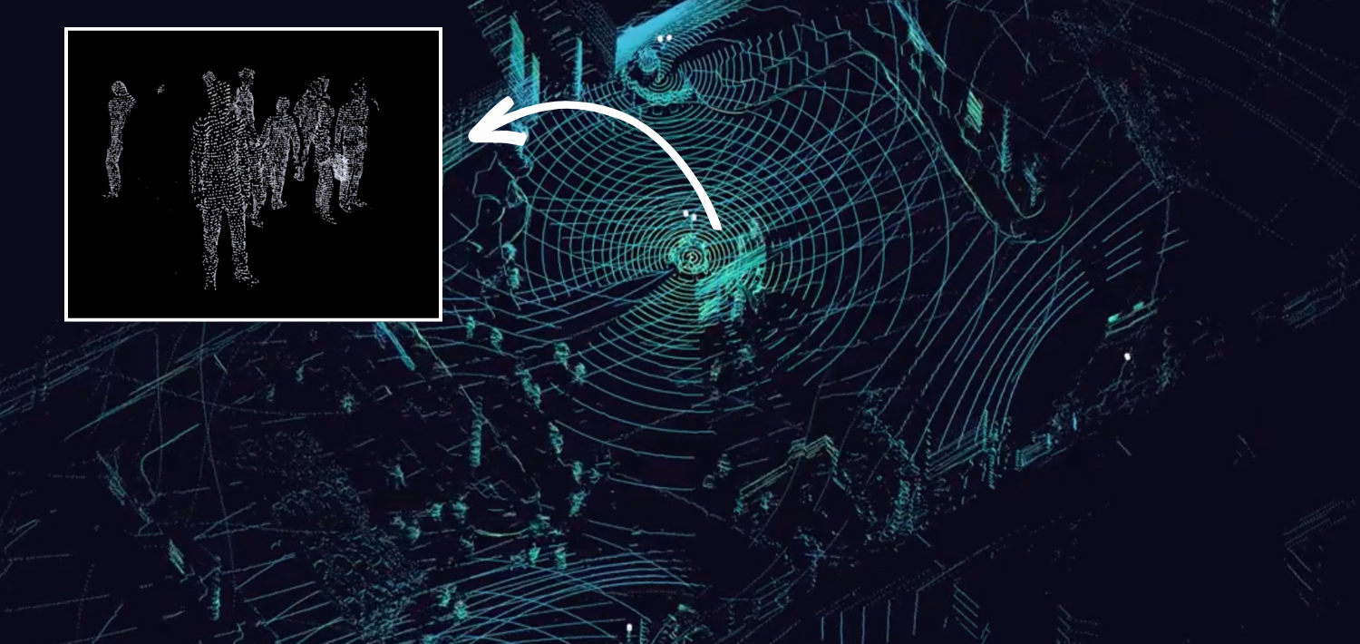
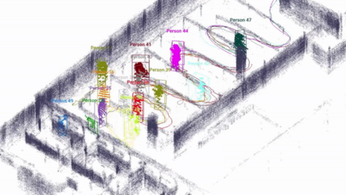
LiDAR presents a wide range of options for ITS systems, including traffic monitoring, smart intersections, the detection of VRUs, near-misses occurrences, and an overall improvement in pedestrian and vehicular safety.
However, the complexity of the data provided by LiDAR, especially when combining many LiDARs in various orientations and locations from different manufacturers, restricts its use in these circumstances.
This is particularly important for Smart Traffic systems as the work at hand necessitates real-time processing at the Edge, which presents a completely different challenge from other circumstances where relatively extensive post-processing durations are acceptable, like in mapping applications.
There are currently 3D LiDAR Software Processors available on the market to solve this issue.
Even though an input contains massive amounts of 3D raw data, when processed at the edge, alongside the sensors, it transforms into Narrow-band data (or requires a narrow bandwidth to be transmitted), enabling, for example, low-power wireless communication.
This is one of its most advantageous features from the perspective of the ITS applications market.
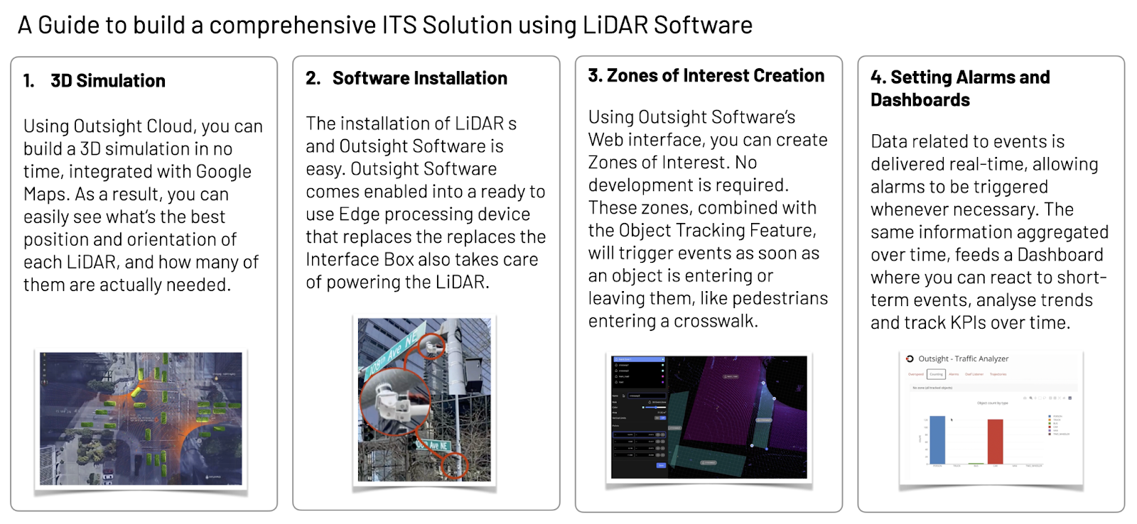
The key processes required to deploy LiDAR in ITS situations at scale is described below:
Large cities all around the world have already made significant investments in ITS systems, including New York City, Amsterdam, Stockholm, and Singapore, opening the door for many more cities to adopt their best strategies.
Because to their great accuracy, adaptability, affordable price, and simplicity of use with the appropriate software, LiDAR systems will without a doubt be employed in this circumstance to speed up deployment.
Read the original article:


LiDAR INSIGHTER Newsletter
Join the newsletter to receive the latest updates in your inbox.


)