What's a 3D LiDAR Software processor?
Running in real-time, LiDAR pre-processing software transforms raw 3D data into understandable, useful information.
From smart cities to autonomous machines, companies in both the public and private sectors are increasingly looking to leverage the benefits of 3D perception.
Five mega-trends are driving the deployment of the technology:
 Outsight
Application developers are turning to 3D LiDAR either to replace legacy sensing technology or to create solutions that were once unachievable.
3D LiDAR is replacing older 2D sensor technologies such as cameras in many use cases or enabling previously impossible solutions.
LiDAR delivers very precise, accurate spatial data and operates at night and in direct sunshine, and when LiDAR is implemented at scale, no PII is recorded.
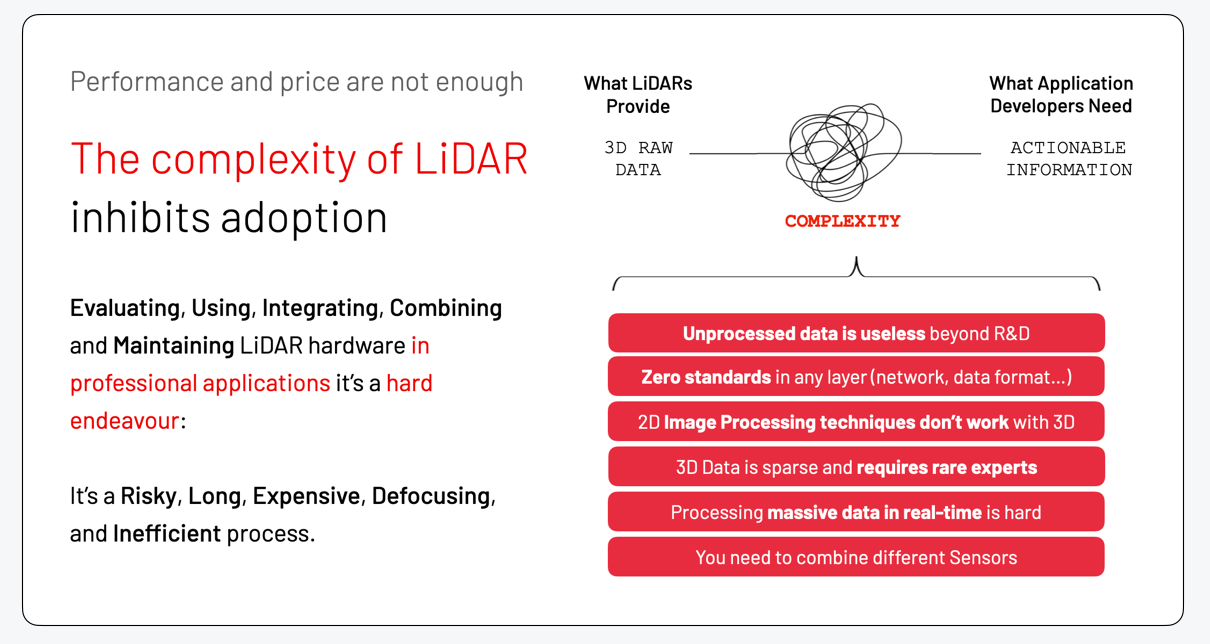
It is not a matter of cost or performance anymore, contrary to the beliefs held by the vast majority of observers whose primary concentration is on the automobile sector;
Instead, the problem is in the complexity that comes along with using this new technology.
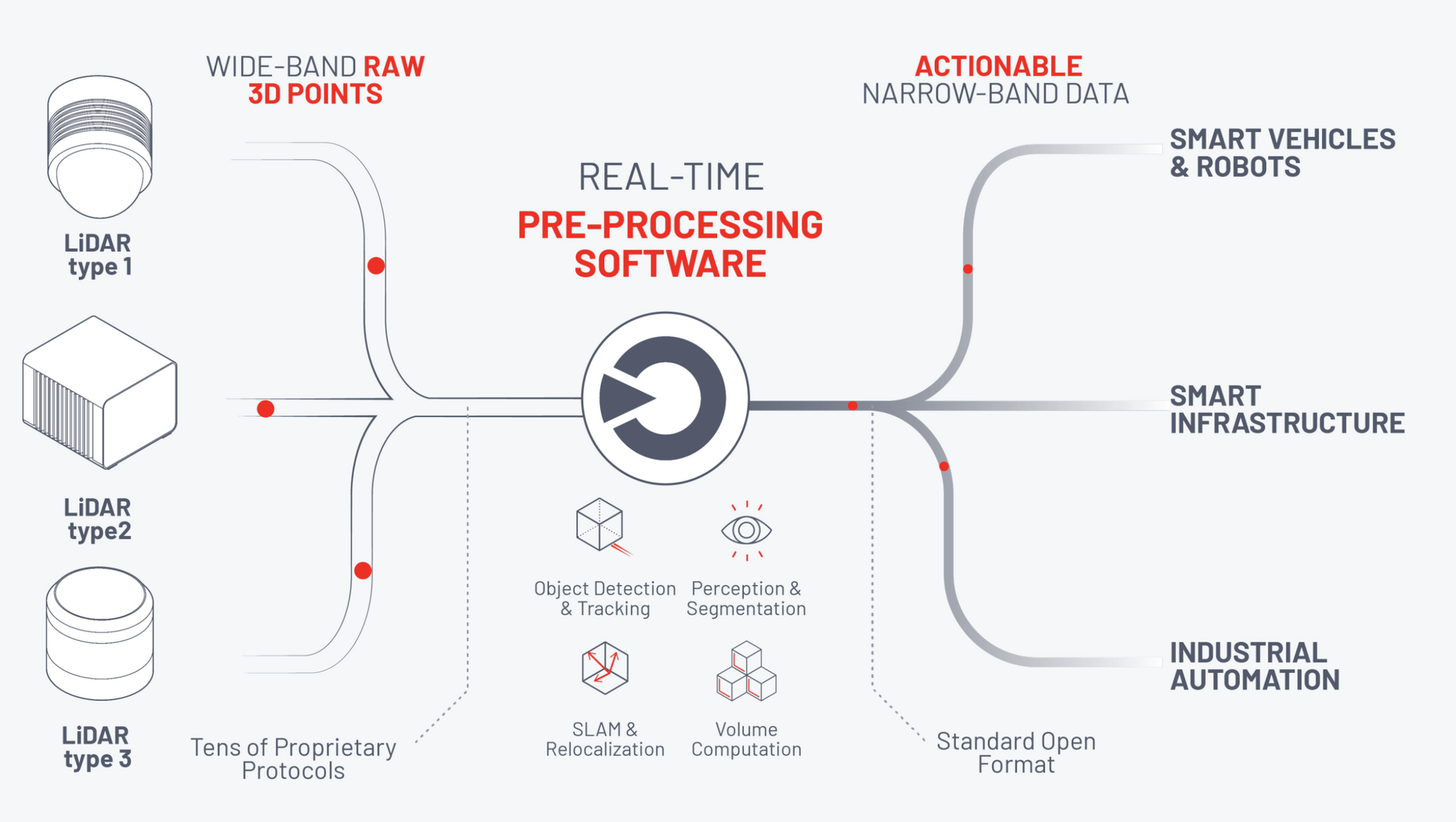
A 3D LiDAR Software Processor turns RAW data into usable information
LiDAR pre-processing software operates in real-time and instantly transforms raw 3D data into understandable, useful knowledge.
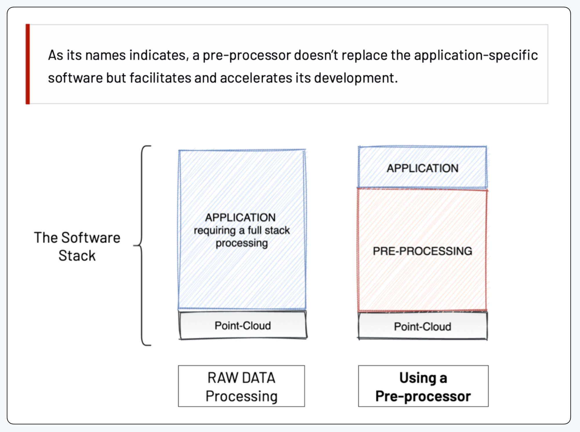
A LiDAR software processor's goal is to streamline the usage and integration of this amazing technology.
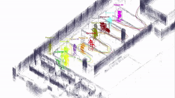
Utilising the following example, let's examine what it means to instantly begin using LiDAR SLAM (Simultaneous Localization and Mapping) for mobile robots and smart vehicle applications without the need to install any framework or software on your computer:
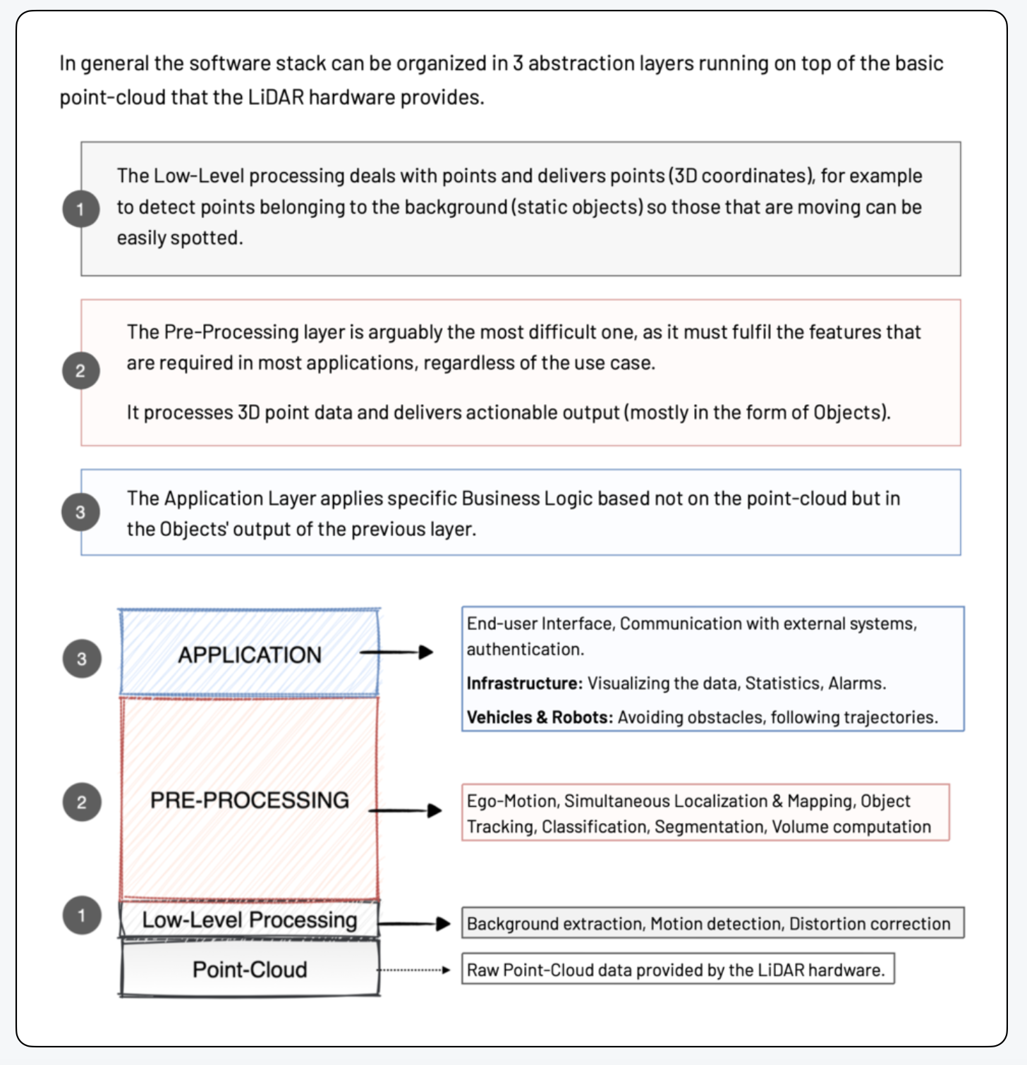
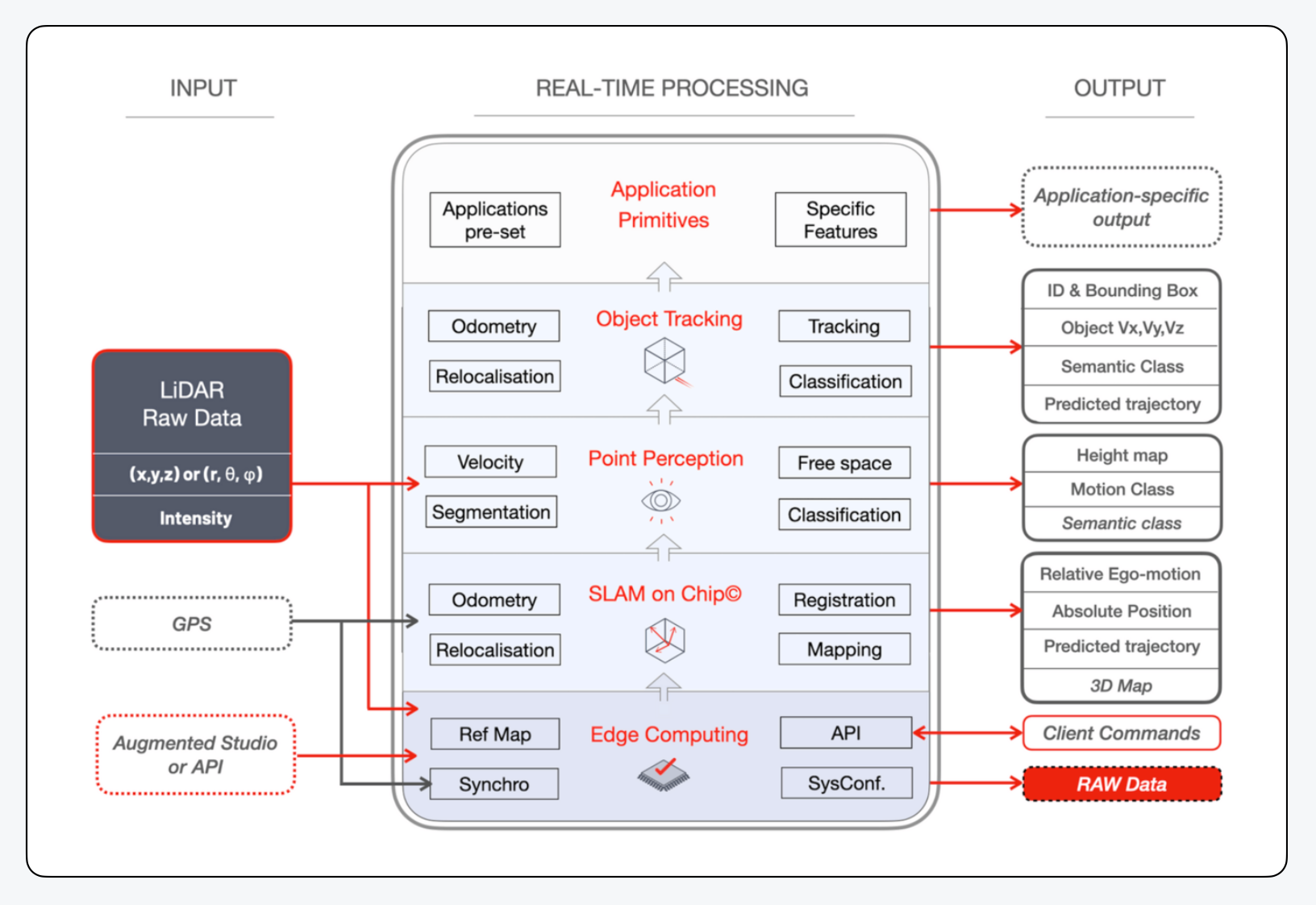
The four primary tasks that a preprocessor executes concurrently in further detail are as follows:
1. Abstracting the Hardware complexity (input): the application developer won't have to worry about developing a special driver for each Sensor or about including features that allow data from many manufacturers to be integrated.
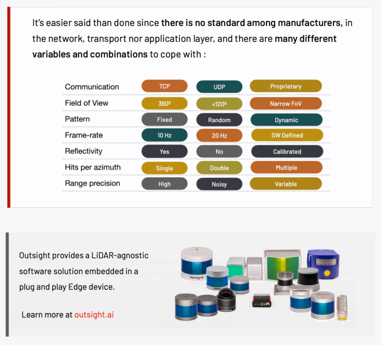
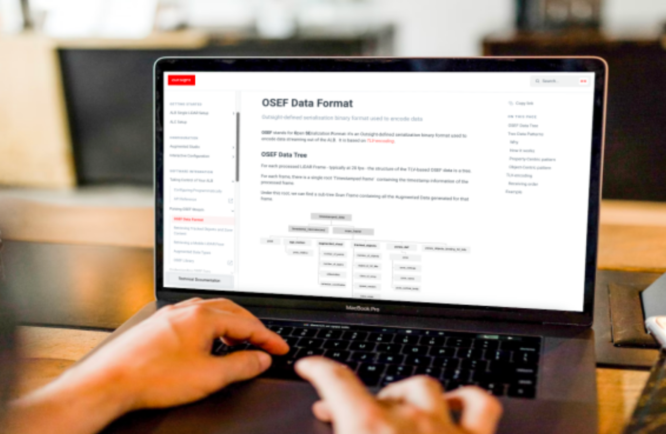
2. Standardising and simplifying the output: when LiDAR initially arrived, using proprietary data formats and protocols made sense since they sped up the release of new devices that delivered raw data. The user was responsible for deciphering each unique format.
In the context of simplifying and accelerating adoption, a LiDAR pre-processor has to offer an open and standard data representation system in order to serve its function.
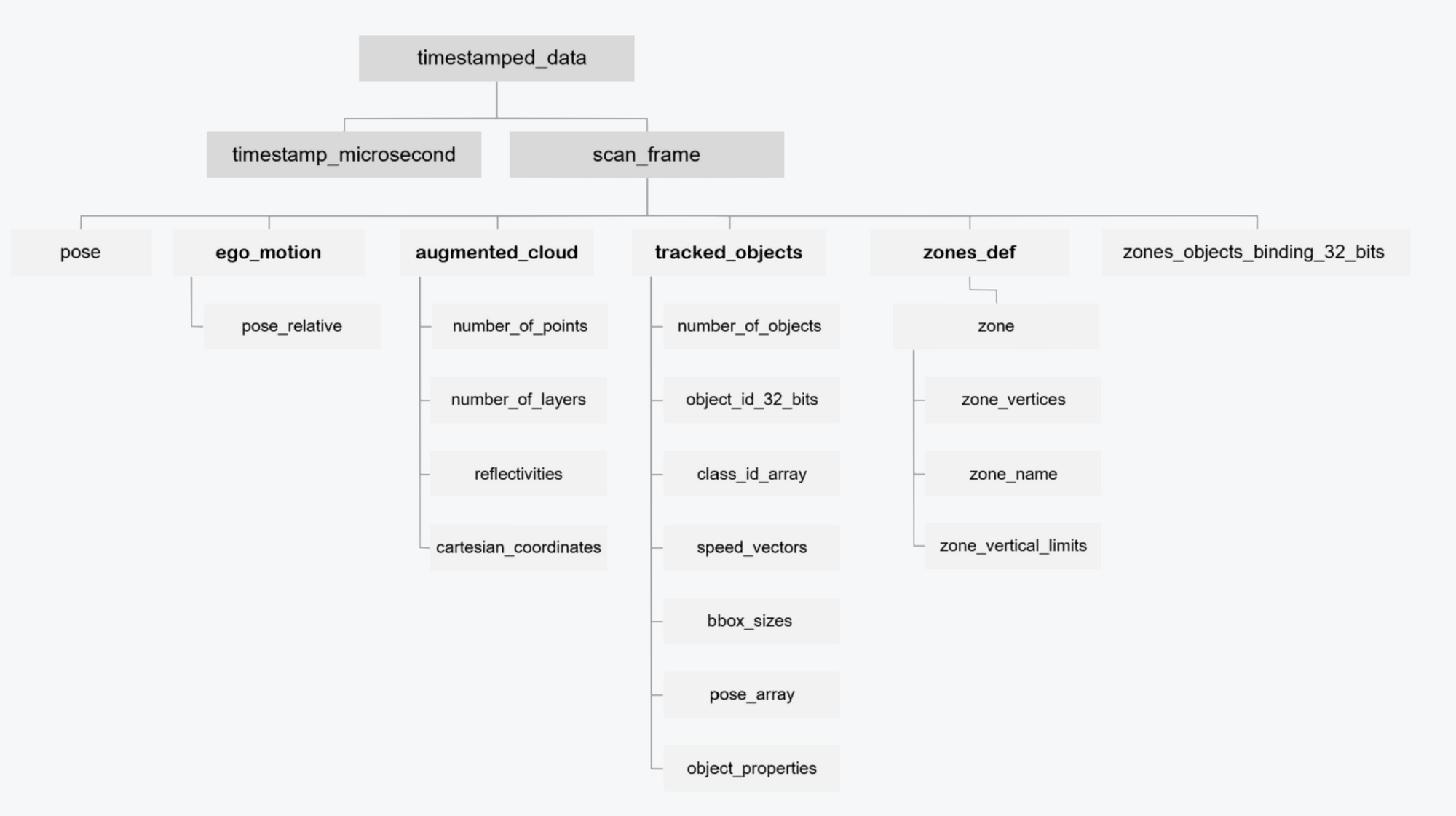
The Outsight's Augmented LiDAR Software delivers its output using OSEF, a serialization binary format, based on TLV-encoding.
3. Reducing the required bandwidth and processing requirements of the Application layers: consuming the entire 3D RAW LiDAR point-cloud at the application level is... pointless. Only information that is necessary for the current application must be provided by the software pre processor, drastically reducing its amount.
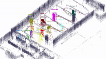
4. Make the data processing heavy lifting, SLAM (Simultaneous Localization and Mapping), Object tracking and classification, Segmentation, Free space detection, Volume measurement, are some of the main aspects that are frequently required in most applications.
The first LiDAR Pre Processor was developed by Outsight and carries out a wide range of tasks in real time, including:
Conclusion
Whether you're an application developer for a Mobile Robot, a Smart Infrastructure project, or an Industrial solution, you can keep current on LIDAR hardware technology and maximize its value with a real-time 3D pre-processor, letting you to concentrate on the application's additional value:
LiDAR technology must advance from its present state as a promising hardware component used by early adopters with specialized knowledge to a solution enabler that can be utilized by mainstream professional users in order to become useable by everyone.
To do this, one must move away from a hardware-centric strategy that delivers complicated, raw data and toward software-enabled actionable knowledge.
Real-time 3D pre-processing software is a new product category that enables a new generation of application developers to take use of the special value of LiDAR data.
Want to know more? Take a look at this related Whitepaper
LiDAR INSIGHTER Newsletter
Join the newsletter to receive the latest updates in your inbox.

